 |
| Big wheels keep on turnin'. |
Mind you, this was no easy feat. There was the time I was on a two day hike in the mountains of Colombia and learned the hard way that iodine doesn’t necessarily kill everything in stagnant pond water. I narrowly avoided disaster in a hastily dug hole, separated from my companions and certain disgrace by a merciful boulder on a barren alpine landscape. May my bullfight souvenir bandana forever rest in peace in its shallow grave in the Andes.
 |
| Me in a Guatemalan bus stop circa 1995. |
And so there I was, only feet from the campground bathroom, and it suddenly became clear that I wasn’t going to make it. A three decade streak was about to come to an end.
Maybe it was the partially cooked cheeseburger from the night before. Or maybe it was that turkey sub in the suspiciously slow sandwich shop on the long drive. Or maybe I had picked up some mosquito borne illness. Whatever the reason, I was about to be dealt a lesson in humility.
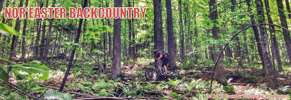
My crappy little problem was terribly timed. I was on my yearly trip with my buddy Brian to the Sacandaga area in the Adirondacks, and we had an epic bike adventure planned for the day. I had mapped out a route that would take us on snowmobile trails, road, and singletrack in a thirty mile loop through the Adirondack backcountry.
 |
| The route |
Neither of us had ridden the route before, but I consulted with the locals. Mike, from nearby Benson, knew the area well and had even recently helped clear the Murphy Lake trail. But he cautioned that he biked only the portion of the ride from Pumpkin Hollow to Wilcox Lake and was so exhausted he stopped and jumped in the lake. I told him of our ambitious route. He just smiled and said, “Good luck”, but the look in his eyes betrayed a hint of “You crazy!”

When I texted Matt from Saratoga and invited him along, his response was also skeptical. He indicated he had aborted an attempt at a similar ride in the area due to all the blowdowns and un-rideable trail. He wished us luck, but he was sitting this one out.
Given these assessments, and my own experience with the snowmobile trails in the area, I knew we were in for a long day. And that was before I unceremoniously soiled myself in the early morning light at the campground.
 |
| Who didn't soil himself today? This guy! |
Despite my compromised undershorts, I was still feeling motivated. And with a belly fully of Imodium and Gu, I felt nearly invincible. Besides, we had the safety net of a bail-out point on Creek Road, where we could retreat on pavement if I decided I wasn’t feeling chipper after the first few miles.
I had put together a GPS track for our route, using the “Route Builder” function on Strava, which I then uploaded onto my Garmin Fenix 3 watch. The Fenix 3 works well, however it is limited to showing you a “breadcrumb” GPS track, rather than showing your position on a map. Thus, you’re travelling somewhat on faith that the GPS track is taking you where you really want to go. The key to using the watch with any confidence is having a map on hand. Although I hadn’t charged my Fenix in a few days, it still had about 40% of its battery life.
 |
| Murphy Lake |
The first couple of miles the trail descends on very rideable single and double track. At the bottom of the descent a patchwork of log braids and bridges crosses marshy forest. Mike had warned us to not even try to ride the logs and sure enough they were so slippery that even walking on them was a dangerous feat. The trail started ascending up out of the marsh in what at times felt like a stream bed. Our choice of fatbikes paid immediate dividends as we coasted above the thick mud, and the chatter of rocks was muffled under our large tires. While technical, the trail was rideable until just before Murphy Lake, where it took a sharp left turn and ran up a steep rocky gully. The mess of slippery rocks and roots made this section unrideable, but the climb passed quickly as we emerged from the woods onto the edge of the lake.
During these first few miles I realized that I had left our map in the car. “That’s okay” I thought to myself, we can simply follow my watch’s GPS track, and I have my phone as a backup just in case”. In the back of my mind, however, there was a nagging thought about what would happen if the battery ran out on my watch. We would likely be without cell service. I turned off my phone anyway to conserve the battery.
 |
| The Lean-To at Murphy Lake. |
We rolled quietly along a flat section between Murphy and Middle Lake making good time. My mind wandered to thoughts of bikepacking the route, and I thought about how the lean-to might make a good backpacking trip with my son and daughter.
After passing Middle Lake at about mile five of our journey, the trail started its long descent to Creek Road. Mostly on double track, the descent was downright fun on the fatbikes. We whizzed along, stopping only once to lift our bikes over a large blowdown. The three miles of descending left us buoyed and confident we could handle the rest of the loop. By the time we reached Creek Road, there was no question we were pushing on toward Wilcox Lake. Its amazing what a three mile descent can do for one’s state of mind.
 |
| Another blowdown. Big surprise. |
It was at that point I could see that Brian was starting to crack. I was still jumping on the bike to ride the painfully short segments between obstacles, while he trudged along next to his bike, head down, sweat pouring off him, looking up occasionally with a 100 yard stare at my feeble attempts to make light of our predicament.
At mile 15 the climbing momentarily stalled, and trail cleared enough for a short ride on flowy singletrack. This was just the lift the both of us needed. We descended back down to the creek dancing along the first enjoyable section in hours. We crossed to the other side on a suspension bridge that was guarded by the biggest orb weaver spider I’ve ever seen and headed back into the woods on the far side, feeling a little less defeated.
 |
| You can almost see the spider. Yes, he was that big. |
At that point we were already four hours into our journey, and we still had another ten miles of trail ahead of us. Neither Matt nor Mike had given us any clue as to what conditions to expect. If they were anything like the last five miles we were screwed. For the first time, I started to think about whether we might end up spending a night in the woods- or worse.
Just like the earlier three mile descent had lifted our spirits, the unrelenting climbing we had been doing for the last ten miles sapped our mental reserves. The fact that the last mile was the steepest didn’t exactly help our morale. But we pushed on and again, relief came just in time. Over the next two miles we made a fast descent on doubletrack down into a hollow and then ran along winding singletrack through an old growth fir stand. In the distance we could see a large pond, light shimmering off the water and into the woods. The blowdowns were surprisingly rare and we kept a steady pace. This was by far the most remote, wild, and enjoyable part of the journey. Where the trail along East Stony Creek seemed well-worn, this trail was much less traveled. Leaves and small twigs cracked under our wheels, and we rolled quickly over the buried rocks.
As the last electrons from my watch battery ticked away into the ether, as best as I could tell we were still running along the GPS track. But for some reason the watch told me we were getting further and further from our final waypoint. That nagging feeling in the back of my mind became a blaring siren of doubt. Was the GPS bouncing off the hills around us? Was there something wrong with my watch? Was it telling me the distance to the next waypoint and not the final waypoint? What if the GPS track was taking us the wrong way?!! Did I set up the wrong route?
 |
| Brian making sure to stay upwind. |
And that’s when we ran out of water.
No water, no food, a dying battery, fading light and no certainty about how much longer you have to go is not a good position to be in.
But hey, at least my shorts were clean (Which I reminded Brian for the umpteenth time that day, its humor having worn off around mile ten.)
Just to make abundantly clear I was lying about our progress the next mile we climbed steadily more than 400 feet, with two sections steep enough to force us off our bikes. I kept just far enough ahead of Brian so that I didn’t have to answer any questions about my navigation.
Thankfully, the distance to the final waypoint began to tick downward again. Suddenly we had only a mile to go, and we emerged from the woods to cross a short bridge, snaking around a metal gate and onto a dirt road. This was our last junction and we were in the homestretch with some life still left in my watch and more importantly, in our legs.
We flew down the road, picking up speed on a long descent and pulled up to the car just about six hours after we had set out.
We exchanged high fives and retreated back to the campground enjoying the cool air and warm light of the early evening flowing into the car. Over beers around the campfire later that night we laughed out loud about our adventure and my rude awakening that morning.
But especially about my ruined underwear.
 |
| Stop... You've reached your destination! |
Thanks for sharing - great story.
ReplyDelete